

This is your Heads Up Message for the potential for severe weather this evening (Monday, 29 July 2024).
Summary of NWS issued OnePager at 1:17 pm on Monday, 29 July 2024:
MARGINAL risk for severe weather. Thunderstorms anticipated to move through the Tri-State region this evening. Forecast show area of concern to our west and south (we are estimated to be on the far eastern edge).
Timing between 9 pm this evening to 2 am on Tuesday.
Straight-line winds are the primary threat, which could lead to tree and powerline damage.
Periods of heavy rain could lead to localized flooding in at risk areas.
Isolated tornadoes are possible.
Note: NWS ILN radar (Wilmington) is down, however, coverage is being sourced from surrounding radar sites (see graphic below OnePager).
EMA Note: We will be on a "conveyer belt" with similar daily weather impacts this week of varying degrees. Stay weather aware and check that weather radio.
NWS OnePager graphic:

Alternate NWS Radar Sites:

NWS Weather Graph as of 1:50 pm:

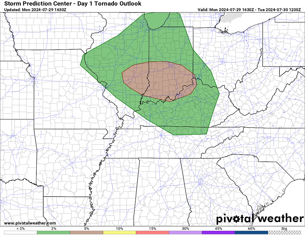
Storm Prediction Center graphics for DAY 1 (today) for the midwest:
MARGINAL Risk for Severe Weather

2% risk for Tornadoes for most of Clinton County (Sabina appears to be <2% risk)
5% risk for damaging winds for Clinton County (that includes you Sabina).

<5% chance for damaging hail.

[END]
Comments